California Floods 2024
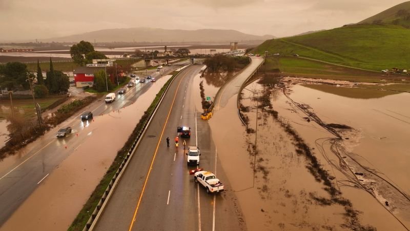
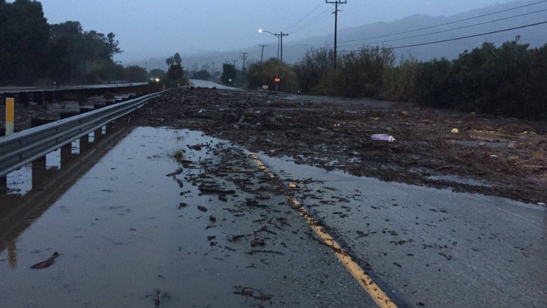
With two major storms and California floods 2024, including an extended atmospheric river event, expected to saturate the state starting on Saturday and continuing throughout the following week, California is on high alert. This weather event follows a storm that hit Southern California in early February and caused hundreds of mudslides and record-breaking rains. Even though the impending storms are not expected to be as severe, the fact that they are coming one after the other and that the second storm is moving slowly give rise to serious worries for widespread flooding and landslides.
The Impending Weather Threat
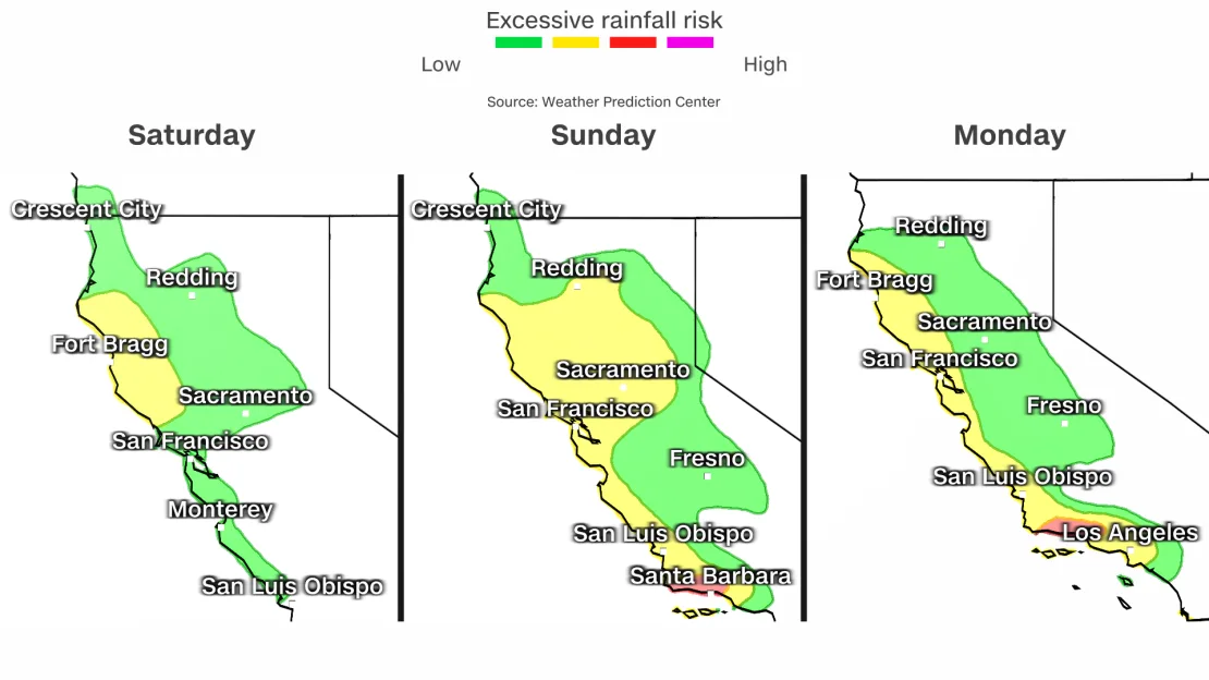
Flood watches are in effect for over 27 million Californians, from the state’s northernmost regions to portions of the Los Angeles region. It is anticipated that the first of these storms will prime Northern California with one to two inches of moderate rainfall, laying the groundwork for the second storm, which is predicted to be more intense. Streams and rivers will rise as a result of this first system’s increase in soil moisture, preparing them for the heavier rain that the second storm is expected to bring on Sunday.
Santa Barbara County emergency management officials have issued evacuation alerts ahead of the heavy storms. The extended length and possibility for extreme precipitation across most of California is highlighted by the National Weather Service’s decision to issue a flood watch for the county, which will be in effect from Sunday afternoon through Wednesday morning about the California floods 2024.

Detailed Forecast
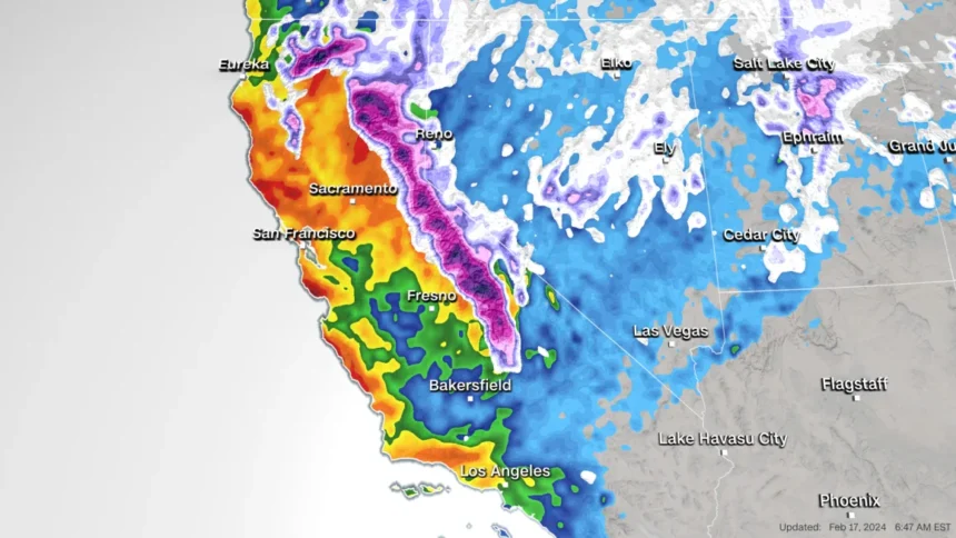
Arriving Sunday afternoon, the second storm is expected to stall close to the coast and dump a lot of rain until Wednesday. During this time, Northern California is expecting 1 to 3 inches of rain in the lowlands and 3 to 5 inches in the higher altitudes. The National Weather Service in San Francisco has issued a warning about rapid runoff and the possibility of many shallow landslides due to the saturated soils surrounding the Bay Area, which is especially worrying.
The storms will be accompanied by powerful gusts, but they won’t be as strong as the destructive hurricane-force ones that occurred in early February. Wind gusts between 35 to 50 mph, however, have the potential to cause power outages and bring down trees.

The Southward Shift
The most intense rainfall is expected to travel southward late Sunday into Monday, primarily hitting Southern California and the Central Coast. There’s a good chance of flooding rain in Santa Barbara; an inch or two of rain could fall there every hour. This heavy rain is predicted to hit Los Angeles by Monday afternoon, posing a serious risk of flooding into early Wednesday.
From Sunday through Wednesday, there will be an incredible amount of rain predicted; coastal areas will receive two to four inches, while higher elevations will receive four to six inches. When combined with the totals from last week, this quantity of rain increases the likelihood of landslides and flooding.
For more weather information follow this official webpage: https://water.ca.gov/Programs/Flood-Management/Flood-Data/Climatology-and-Meteorology

Snowfall Projections
In addition to rain, significant snowfall is predicted to be brought to higher altitudes by the storms. By Sunday morning, the first storm is expected to dump 4 to 10 inches of snow on the southern Cascade mountains and the Sierra Nevada. More substantial snowfall is anticipated from the second storm, with accumulations of up to 4 feet on the highest peaks and 1 to 2 feet in locations above 5,500 feet.
During this time, the Sacramento National Weather Service office has strongly advised against traveling to the mountains due to snow-covered roads, chain controls, poor visibility, and possibly road closures.
A State on Edge
The focus in California is on readiness and caution as the state gets ready for these storms in succession. The likelihood of substantial flooding and landslides serves as a clear reminder of how susceptible the state is to severe weather. It is advised that locals in impacted areas follow evacuation orders and get ready for the effects of severe rain and snowfall. As the state attempts to navigate through yet another difficult time of extreme weather, emergency services are on high alert and the community is preparing for what lies ahead.
For more content like this follow our official webpage: https://www.brightstarnews.com/


